View southeast across the entrance to Maines Rockland Harbor toward Owls Head (right) and Vinalhaven Island.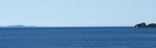
Above: Rockland, Maine, was the location of a measured mile used by destroyers during speed trials. Multiple northbound and southbound runs could made thanks to a combination of sheltered water and sea room for turns. This view looks southeast past Owl’s Head across West Penobcot Bay toward Vinalhaven Island. Many images on this site of
Bath-built destroyers at speed during trials conducted in the 1930s and ’40s were taken here, including ones of
Dewey,
Anderson,
Nicholas,
Barton and
Frank Knox.
This section contains color photographs of sites familiar to World War II veterans as they appear today. They were taken during cruises of the 340-foot
Clipper Odyssey to the
Solomon Islands in 2005 and the
Philippines in 2007.
« « «
- Papua New Guinea — Port Moresby to Milne Bay.
- Guadalcanal — including Purvis Bay and Tulagi.
- New Georgia — including Viru Harbor, Blanche Channel, Rendova and Ferguson Passage.
- Kolombangara — including Blackett Strait, Vila-Stanmore Plantation, Kula Gulf, Hathorn Sound, Bairoko Harbor, Enogai Inlet, Vella Gulf, Vella Lavella, Gizo, Gizo Strait and Wilson Strait.
- Bougainville — including Mt. Bagana, Empress Augusta Bay, Cape Torokina, Mt. Balbi, Buka Passage and Buka.
- Rabaul — including St. George’s Channel, volcanos and Simpson Harbor.
By Sea through the Philippine Islands: